When hiking in the backcountry, or even exploring new areas in the front country, knowing where you are and where you are going adds confidence and safety to your outdoor experience. Until recently, tracking your location required purchase of a dedicated GPS unit. However, now nearly every smartphone and tablet is equipped with a GPS receiver that can track your location whenever you have a clear view of GPS satellites (basically everywhere on earth).
With a mobile app your smartphone or tablet can now double as your GPS unit to display your location, your movements, and maps of surroundings, even when you don’t have internet connectivity. Some important, even essential, features for navigation apps are the ability display your location, store downloaded maps for offline maps, record your movements, and show existing trails and routes. If you’re just getting started with outdoor activities or GPS navigation it’s best to start with a free app so you can get a feel for the features you require from a paid subscription. Luckily, there are a lot of free and freemium options out there.
Any reliable outdoor navigation app needs the ability to track your route or record waypoints, show trails, and display offline maps. I scoured as many free navigations apps as I could find to come to this list of 5 that meet those requirements.
1. Hiking Project
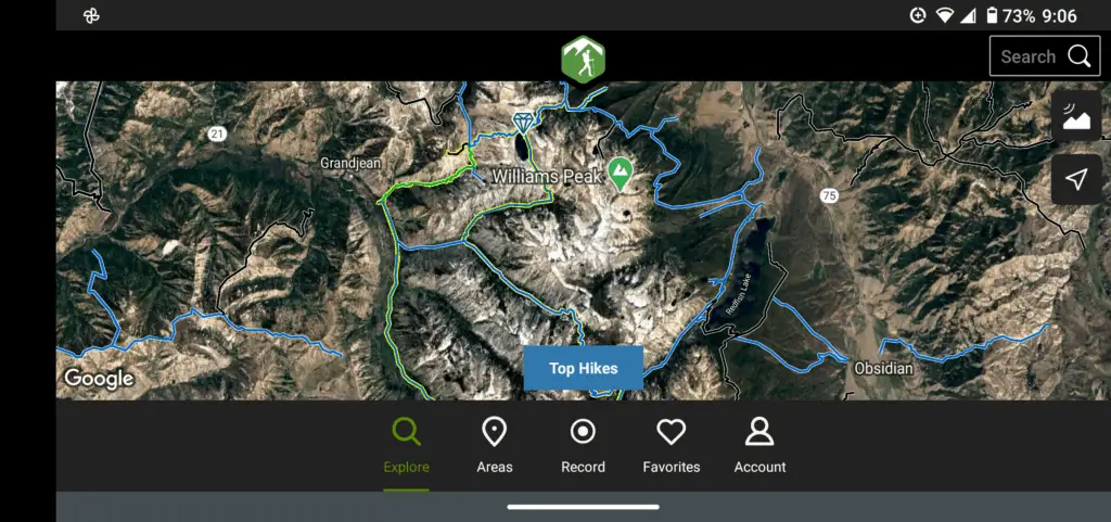
Hiking Project is a completely free navigation app. There is no premium plan, so you won’t be bombarded by advertisements. A large database United States trails is available in the Hiking Project app, and trails can be downloaded for offline use.
While you can download trails, the basemaps are not automatically downloaded, which is disappointing. You can work around this by zooming into an area of interest while connected to a network. The basemap will be saved in the app’s cached memory and will be available later while offline. Just beware, this may not be the most reliable way to have an offline basemap. If you really need a basemap, Wikiloc may be a better option for you .
You can track your hiking routes and save them to your account directly from the Hiking Project app. Tracks can be shared and saved to use a later date. There is no functionality to record waypoints or points of interest.
Hiking project is a great value for a completely free app. The huge trails database will help you find outdoor opportunities near you. Including a way to reliably download basemaps would make this one awesome free app, but you can’t have everything.
2. Wikiloc
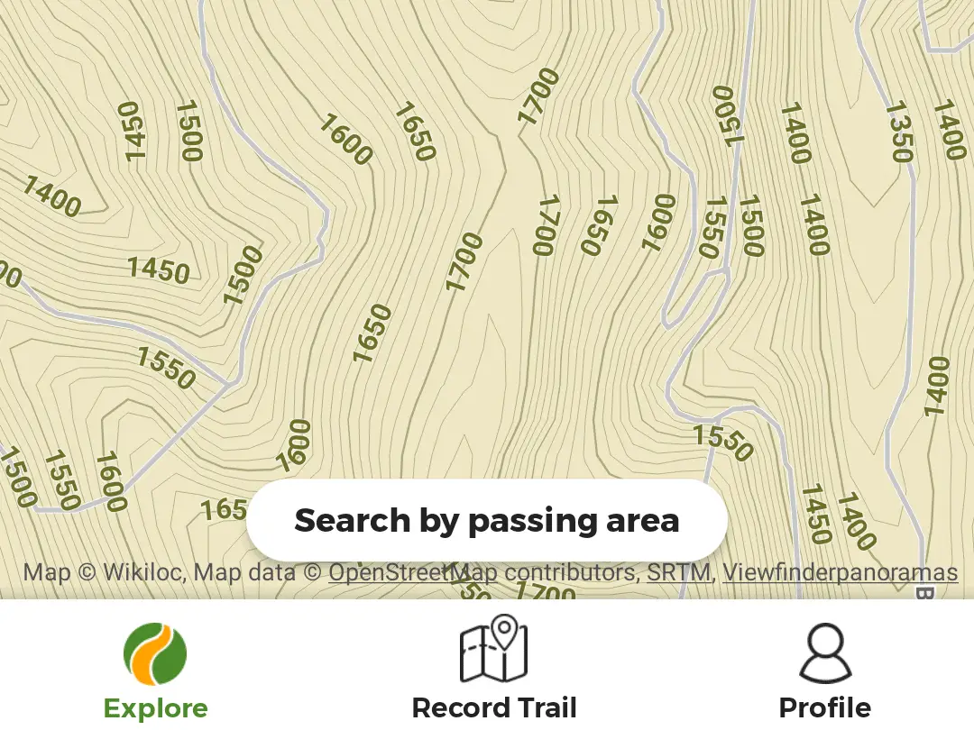
Wikiloc has a world-wide downloadable trail database and downloadable basemaps. The trails and basemaps you download are accessible offline. Wikiloc’s topographic basemap can be downloaded for free. For a free app, the basemap is quite good. The topographic map shows trails, roads, landmarks, and other features of interest. The one downside, is that offline maps can be slow to load.
You can track your location and save your routes to the Wikiloc app and your online account. Wikiloc does not have the functionality to collect waypoints. You can upgrade to the premium version to get additional navigation, tracking, filtering and weather features. However, I think there are better paid options out there.
Wikiloc and Hiking Project are the two best outdoor navigation apps that are free. Compared to Hiking Project, Wikiloc has a smaller trail database, but better offline maps. The free version of Wikiloc is great, other paid apps offer more value than the premium version.
3. E-walk
With the E-walk mobile app you can download a basemap and record your tracks. E-walk also lets you upload tracks. However, there is no trails database, so the app won’t help you find new trails. The only basemap available for download is Open Streets Map (topography and satellite maps area available with a network connection), which is not an ideal map for navigating during outdoor pursuits. The free version of E-walk also contains adds. For a free app E-walk is okay, but you’ll get more value from Hiking Project or Wikiloc.
4. Avenza Maps
Avenza is a unique mapping application that doesn’t use traditional basemaps, but instead lets you search and download georeferenced maps for specific areas. For example, you might find a map from a state wildlife agency showing the range of a species, specific hunting units, or the location and results from a study. Avenza Maps are downloadable for offline use (for free). In the free version Avenza also gives you the ability to mark places (points) and record tracks. Data you record in the app can be exported. If you upgrade to the paid version of the app you will gain the ability to upload files. Avenza will help you find some neat maps of different areas, but it’s probably not the best app for general outdoor navigation.
5. ViewRanger
ViewRanger has the minimum requirements to qualify as a useful, free navigation app. However, I found it quite difficult to navigate. It supports a decent trails database and allows you to find trails near your location. Downloading maps for offline use can be a bit of a problem. I was only able to download maps along trails in the ViewRanger database. I couldn’t download maps along routes that I had created. This could be a problem if you’re looking to get off the beaten path or try a hike that isn’t in the ViewRanger database.
Otherwise, ViewRanger offers a little more functionality than the above apps. You can view multiple basemaps and mark waypoints. There are also premium features available (and presumably better download support) if you upgrade to a paid plan. Before you dish out the dough for a paid plan you should check out some other apps, because I think there are better options out there.
Conclusion
Wikiloc and Hiking Project are the two best free outdoor navigation apps because they give you access to a large trails database, allow you track and save your routes, and give free downloads of topographic basemaps. The other apps in this list could also work for you depending on your specific circumstances. Avenza maps could be useful to find unique maps or navigate to features that may not be available on generalized basemaps used by most navigation apps.
There are many free mobile apps to get you started with outdoor navigation. They will let you track where you go so you can get back to where you started without getting lost. However, for more functionality you will need to part with some of your hard-earned cash. I recommend starting with one of these free apps until you get a feel for the features and functionality you’ll require from more premium offerings.
